SL1 Northern Block flooding - Kahikatea Dr to Collins Rd
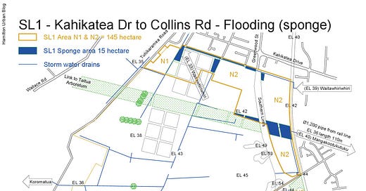
My concern with the SL1* original written proposal presented to Future Proof is that it makes no mention of the nature in the cities goal of 10% of the land area being in its natural state. The report does include ‘Future development of SL1 will need to provide for the existing flood storage volume .... The primary means of flood storage will be via wetlands or dry basins, which will be designed to accommodate flood water during storm events’ (Future Proof Hearings Subcommittee Hearings 21 March 2024 - Agenda p.468. pdf p.393. 5.5.2. Retention of Storage Volume). My map below shows what 10% wetland (blue) could look like. I am not sure whether a dry basin is a good idea within the 10% shown, as in times of extreme dryness we need to retain ground water levels and vegetation (green).
*SL1 owns land ... adjoining the Hamilton City boundary to the south-west boundary ... identified by Hamilton City Council (HCC) as an ‘Emerging Area – Market (link Agenda page 371. pdf p.296)
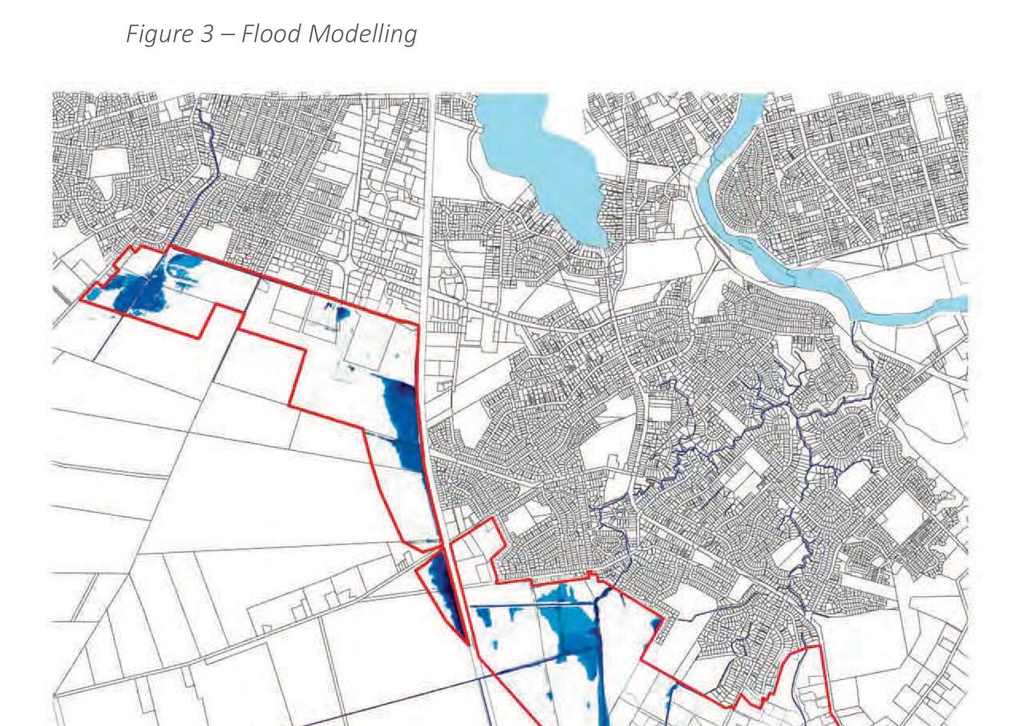
Hamilton presently has less than 2% native vegetation. Using 10% as an absolute minimum starting point for the drawing above, the map shows only areas near to where stormwater exits the area into the Waitawhiriwhiri and Mangakootukutuku streams. The location of existing flood-prone areas is shown below.
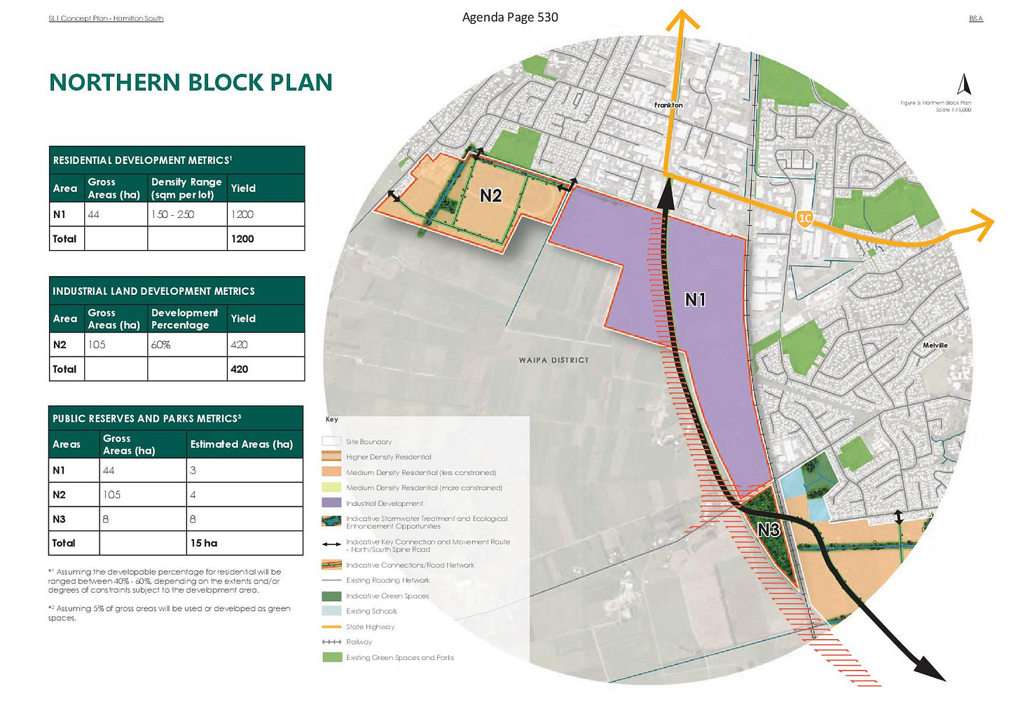
The SL1 northern block proposal for the N1 residential area of 44ha with 3 ha (6%) for parks, N2 industrial area of 105ha with 4ha (3%) of parks, includes an area N3 of 8ha to achieve a total of 9.5%. There is also a statement that ‘5% of gross areas will be used or developed as green’. The first image shows 10% in both areas N1 & N2. Some of the blue areas in the first image do not meet the native vegetation area benchmark, as they less than 50 metres^ wide..
^How do we measure restored land? ‘The minimum width of the feature, at any one point, must be no less than 50 metres’ (2012 Whangarei Biodiversity Strategy p.62).

The updated SL1 presentation to the Future Proof Hearings Subcommittee 21 March (end of Recording #4) added much more detail and showed much larger flood (blue) and vegetation (green) areas, especially in the Southern block.
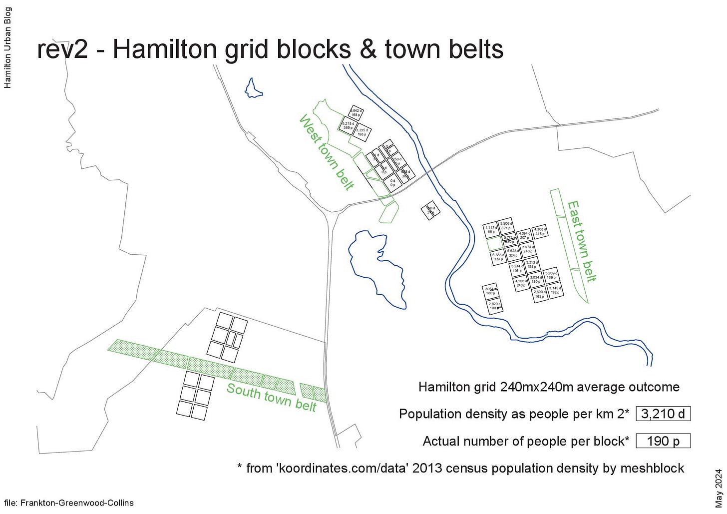
I am not qualified to recommend how to plan new areas. My interest in this project is to promote what works in the real world. Hamilton’s original 1860s town plan included green belts and some 240m square grid street neighbourhoods, which have provided good liveable outcomes. I would like to see a similar green belt in the south and a number of 240m x 240m grid blocks added to Hamilton’s landscape, to see whether past good outcomes can be repeated.
Past posts: Kahikatea to Collins land for green biodiversity and Kahikatea to Collins zoning.


