Kahikatea to Collins storm water drains
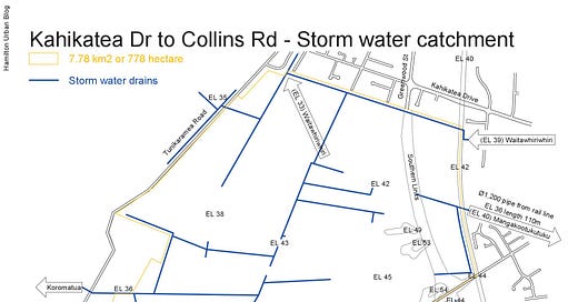
With the increased likelihood of weather bombs, cities need more land that can act as a sponge to slow down the speed at which water moves. The land south of Kahikatea Drive to Collins Rd looks to be an ideal extension of Hamilton’s boundary, tidying up the odd off-shoot to Temple View. What I have not found is a reliable map showing which existing drains feed the three different streams (Waitawhiriwhiri, Mangakotukutuku and Koromatua), so I have drawn my own.
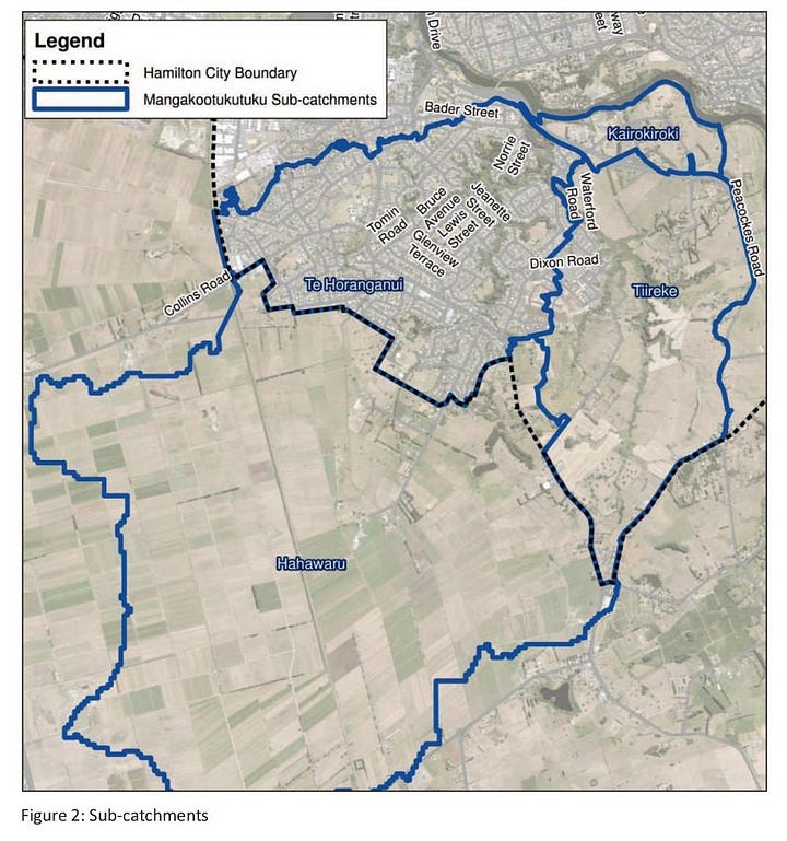
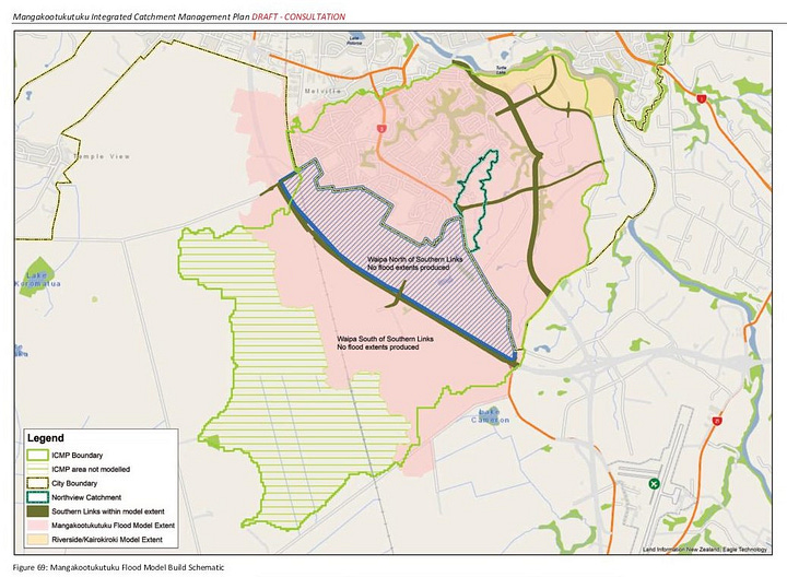
What I have noticed is that most catchment maps do not include the Mangkootukutuku catchment in this area, as can be seen on the left map below, even though the map on the right shows the flood plan extending inside the Kahikatea to Collins area.


What this extension will do is put the entire catchment of the Waitawhiriwhiri stream inside the city boundary, so a single council will be responsible for managing its water quality.
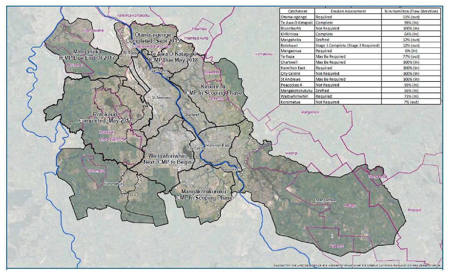
This last map above shows the percentage of flow from different stream catchments that Hamilton city council manages.
References
Mangakootukutuku integrated catchment management plan - Nov 2020 - https://www.streamcare.org.nz/Mangakootukutuku%20Integrated%20Catchment%20Management%20Plan%202013%20Draft%20for%20Consultation_KC.pdf
A Hamilton City Experience from Creation to Implementation - https://www.waternz.org.nz/Attachment?Action=Download&Attachment_id=2881


